
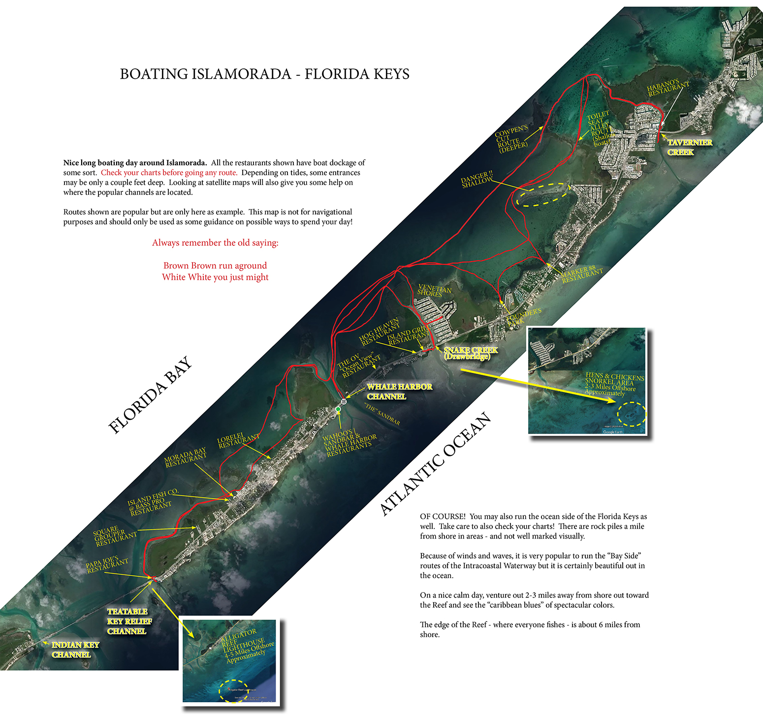
Map of Islamorada Day Boat Routes
Where are Islamorada popular area day boat rides / cuts for sight seeing and restaurants? Many area maps of popular routes and destinations are below.
Learning how and where to boat around the Florida Keys can be difficult! There is a lot of shallow water and you must understand the marker system to not run aground. There ARE plenty of great waterways and it is quite beautiful once you boat the best routes.
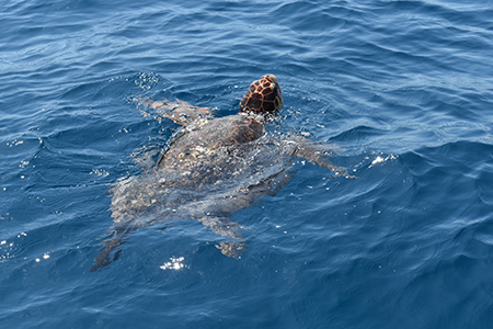
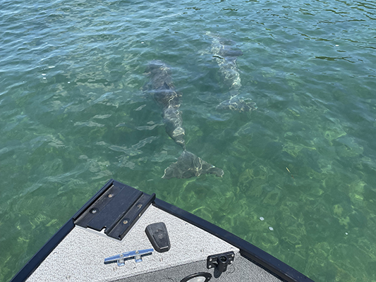
Keep your eyes on the open water where you'll see turtle, dolphin, flying fish, stingrays, and large fish jumping out of the water regularly.
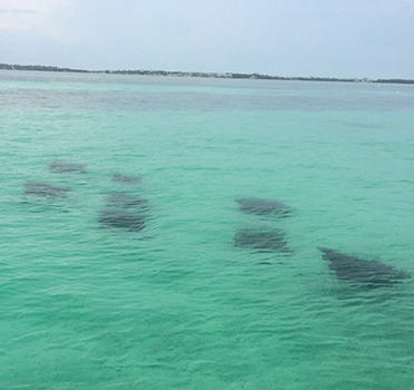
Stingray swimming across the Sandbar above | Turtles everywhere out on the ocean
Know the tides to boat around the Florida Keys safely. This Tide Chart is handy reference for Islamorada.
Routes were made by small fishing boat with shallow draft. Tides can go up and down several feet. Maps are for reference ONLY. It is up to you and the captain to decide which waterways fit your vessel based on current water depths. GREAT to have a GPS Plotter to save your routes to ease the sometimes confusion on markers and looking for small white "sticks" to guide your way in deep channels.
![]()
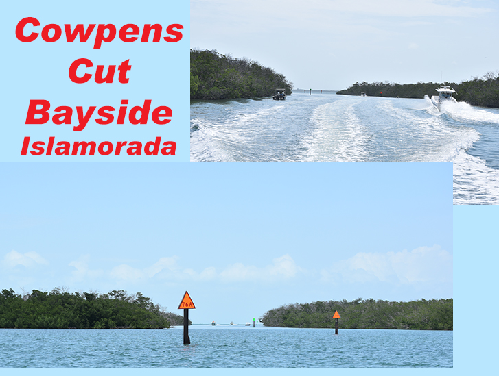
Tavernier Creek through the Cowpens Cut on the Bay Side
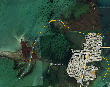
If you look at your charts, the Intracoastal Waterway will take you through this set of mangroves above to maintain deep water (Cowpens Cut) image from Google Maps witch is also a great way to view the cuts before you go! People also fish inside here on windy days for Mangrove Snappers. Watch for dolphins here too.
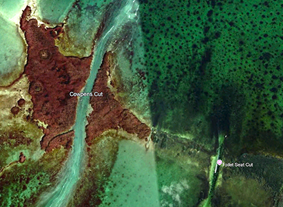
Cowpens Cut
Take a ride through the mangrove forest as you leave the bayside and enter the Tavernier Creek heading toward the Atlantic
There are many houses on the Tavernier Creek... birds, manatees, and dolphins passing through. You'll also find the Cuban restaurant - Habano's on the Creek.
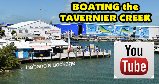
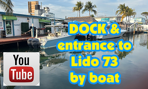
If you pass under the Tavernier Creek Bride, you will find a few canals here that are enjoyable to take a ride down. The first canal from the bridge has a restaurant at the end of it... Lido's 73.
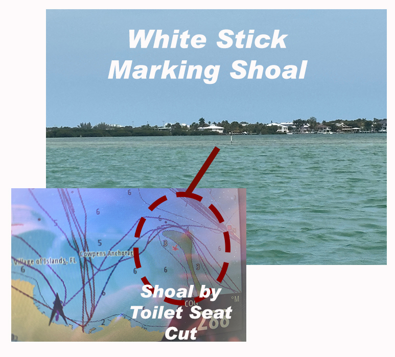
The famous Toilet Seat Cut boat route can also be found within this portion of Islamorada. Getting to this cut however is not for first timers because of water depths. The video below was taken with a 16' boat traversing through 100's of decorated seats. The water nearing high tide to "enter" this area was about 2' deep for reference. Check your charts & tides so you don't hit bottom on the way there from the south to decide for yourself.
Beware! Large shoal within this bay area!
Here's an interesting article on How Did the Toilet Seat Cut come to be?
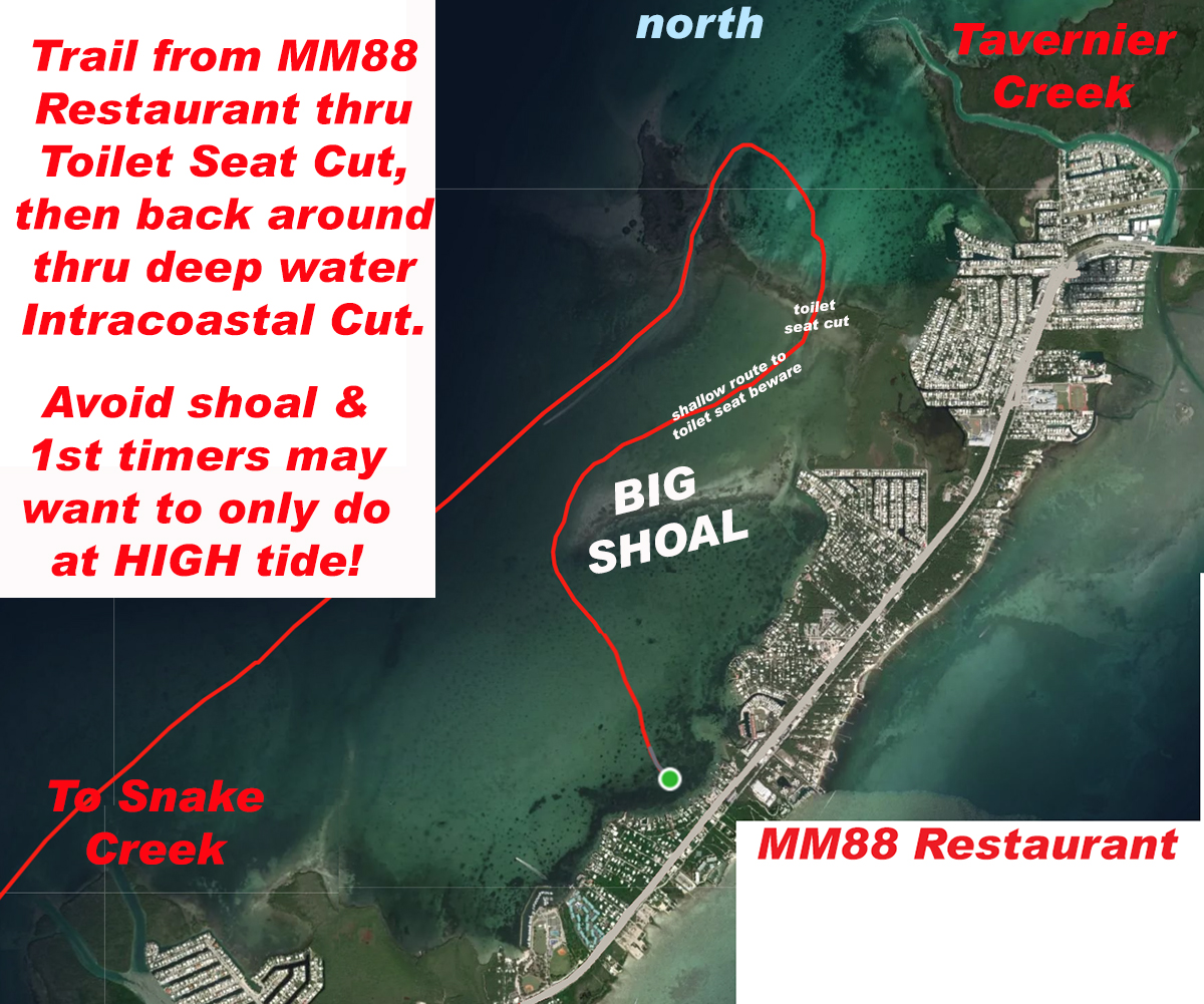
Check out the restaurants section by Mile Marker to see dockage images and videos of many more restaurant destinations... including MM88 Restaurant above.
![]()
Traveling around Windley Key from Whale Harbor Bridge is a great simple ride for most size boats. Watch for dolphins feeding along the route on the Bay Side - especially early evening. This route is marked fairly well too. During low tide, the water in from of the OV Restaurant can be down to 2'-3' as you get close to the dockage area. Same goes for the entrance to Hog Heaven from the Snake Creek - there are "white sticks" marking the entrance way which is also very shallow at low tide.
Just past the bridge on the Atlantic side are two restaurants... Hog Heaven and the Island Grill at Mile Marker 85. Check out the full restaurants section by Mile Marker to see dockage images and videos of many more restaurant destinations.
We regularly see dolphins in the channels and on the bay side... and out in the ocean too as you saw in the video above! We have had interactions the most on the bay side, especially early evening. Keep an eye out and I'm sure you'll see some.
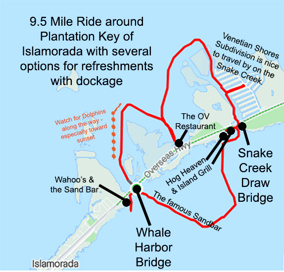
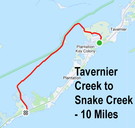
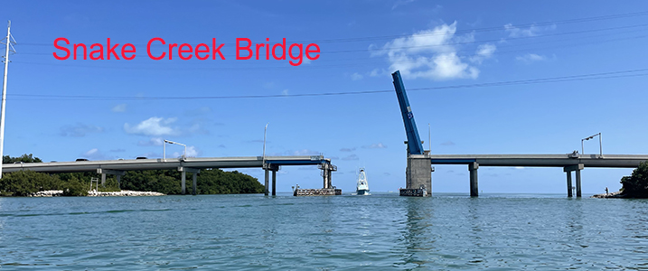
Sight seeing around Islamorada by boat on a windy day? A relaxing "out of the wind" ride day is on the Snake Creek which takes you from the Florida Bay out to the Atlantic Ocean. This deep water route is home to the Venetian Shores Subdivision (see map above). There is a draw bridge for the tall fishing boats heading out each day. You'll find wide canals to check out the beautiful homes (see video below) - watch out for Dolphins and Manatees inside the canals to not harm them.
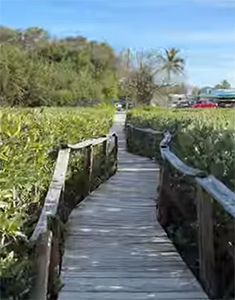
There are several restaurants you can visit... some not so easy with a deeper draft. The Dunn's OV on the bayside is a neat stop full of locals. This is fairly shallow at low tide. Here is a short video clip of their dock and mangrove walkway from the docks.
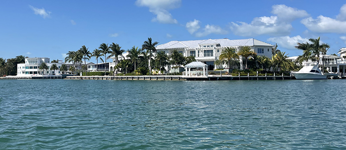
Snake Creek is a great way to spend some time for just a boat ride. Many fabulous homes on wide canals to do some touring around. Good idea if too windy to get out onto the ocean. Fishing by bridges is also very popular.
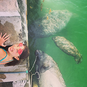
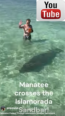
As you travel through the canals and creeks, keep your eye out for manatees as they are often seen at the surface. You need to take care not to hit them as they don't always move out of your way quickly.
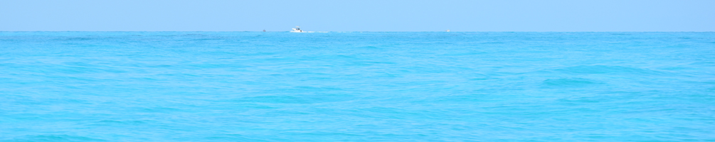
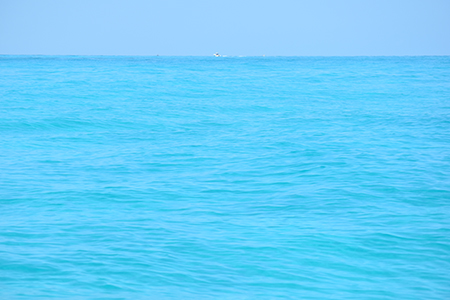
As you head out into the Atlantic, once you get out over 1 mile... the next few miles will be the most beautiful Caribbean Blue water like a giant swimming pool.
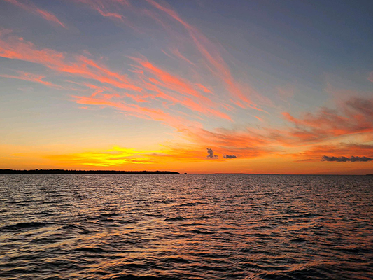
And don't forget... it is free to watch a beautiful sunset! If you are not familiar with the waters, get back to the dock before dark - it is VERY DARK here and difficult to find markers at night.
![]()
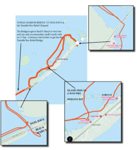
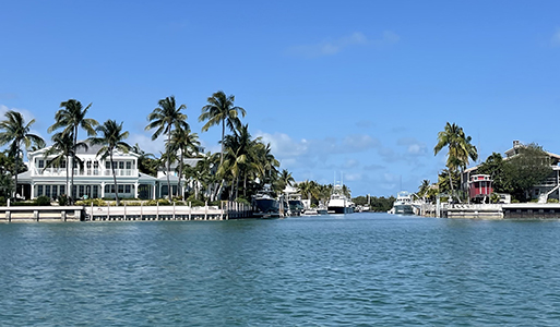
Traveling UPPER MATECUMBE "Bay Side" from WHALE HARBOR (by the famous Sand Bar mooring area) to PAPA JOE'S is approximately 7.5 mile "one way" trip on the bayside. There is dockage at Whale Harbor|Wahoo's|Sandbar, Lorelei, Morada Bay, Island Fish Co & World Wide Sportsmen (Bass Pro), Square Grouper, and Papa Joe's. See Restaurant listings for pictures of dockage available.
Below video is cruising along the shoreline on the Atlantic side of Islamorada - beautiful water colors.
As you head under the Whale Harbor Bridge you will immediately see the famous Islamorada Sandbar.
Entering from the Atlantic Side? Here is a short video of that end - with a quick "drive-by" of the boats on the Sandbar today.
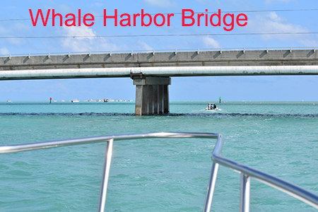
The Whale Harbor bridge can accommodate most average size fishing boats and center consoles with T-tops. If you have a flying bridge, you'll need to go to the draw bridge at Snake Creek. DON'T forget to put down your antenna's and fishing poles however at high tides!!

The Tea Table Key Relief Bridge next to Bud 'n Mary's Marina and Papa Joe's can only accommodate small low profile boats. You'll need to head down to the next southern bridge another mile or so to get your center console's to the ocean.
The video below is the winding ride from Bud 'N Mary's Marina, passing Papa Joes, then through the backwaters where the Square Grouper is located. We continue on and come into the bay where you'll find three restaurants and bars nestled around the Worldwide Sportsmen with dockage. You can see images of dockage within the restaurant directories.
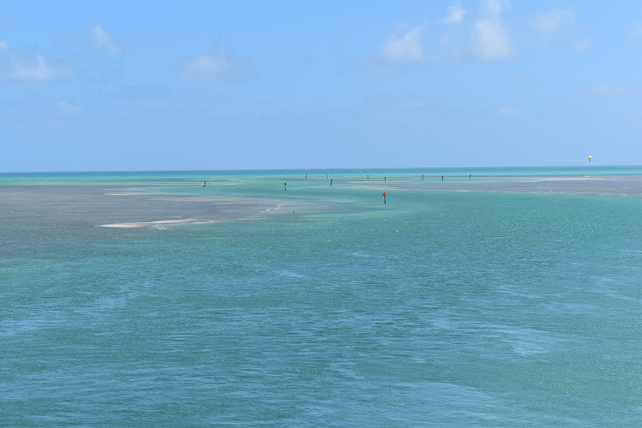
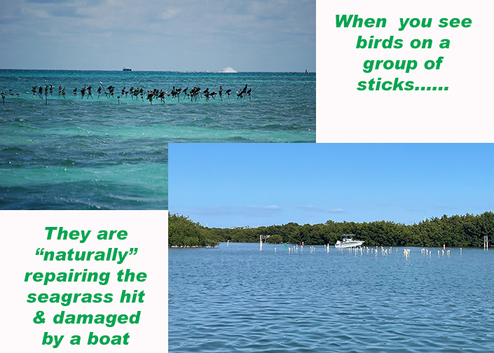
Traveling around the Keys you will see "groupings" of white stakes. If you run aground with your boat and damage the sea grass you may be ticketed. So if you see a group of sticks - shallow water.
![]()
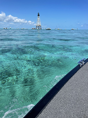
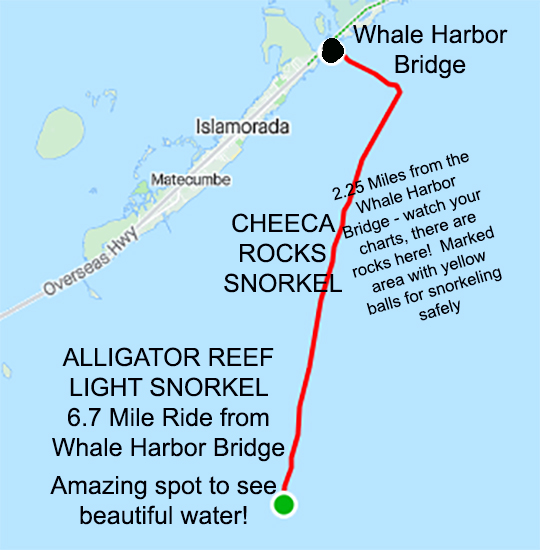
Traveling from WHALE HARBOR to ALLIGATOR REEF LIGHT is a wonderful ride. Alligator Reef is about 6 miles off shore and is on the edge of the reef where water drops from 10 feet to oblivion. Out here you'll see "swimming pool" water color with white sand bottoms. Can be a bit wavy when the winds are high. Most come out here to snorkel and swim when winds are under 10mph. Makes an enjoyable afternoon place to hang out! The water is too deep to stand, so be sure to bring a raft to tie to the boat and float around.... or your snorkel!
Along the way are the Cheeka Rocks snorkel area. Watch your charts since there are some shallow areas along the route. Please note - "yellow balls" mark a snorkel area, there is NO fishing allowed inside this area by law. Please also watch your speed inside these areas for people snorkeling.
![]()
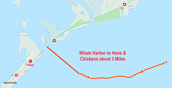
From Whale Harbor to Hens & Chickens is also a fairly short ride. NO fishing within these Yellow Ball marked sanctuaries. You can tie up to a white ball and feed the fish with some bread and crackers. No need to jump in to snorkel... but it's a great time if you do. Watch for the tower and yellow balls to know you've arrived. ***ON THE WAY OUT - please watch your charts as there is a group of rocks just to the north of this route mapped below about 1-2 miles offshore! At low tide you might hit these with your prop ***
If you are coming to snorkel, tie up to different balls as they each provide a different experience. Some balls you will see more fish and others, more rocks / coral and fauna. If it is a really busy day, we have also asked if we could tie up to another boat and drift behind them... no one has ever said no, so don't be afraid to ask.
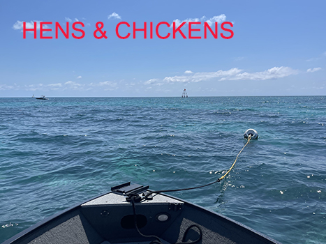
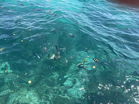
Boating up to Hens & Chickens with amazing clear water view.
![]()
Traveling from WHALE HARBOR (by the famous Sand Bar mooring area) to GILBERT'S north of Key Largo is approximately 26 mile "one way" trip on the bayside along the Atlantic Intracoastal Waterway. There is dockage at Gilbert's, Black Water Siren, Jimmy Johnson's Bill Chill, Caribbean Club, Snooks, and Bayside. See Restaurant listings for pictures of dockage available.
Check out the short video traveling within the Intracoastal Waterway inside Florida Bay during a day trip here. The trip is well marked - check your charts or GPS. There are shallow waters so if you don't know the area - stay in the markers.
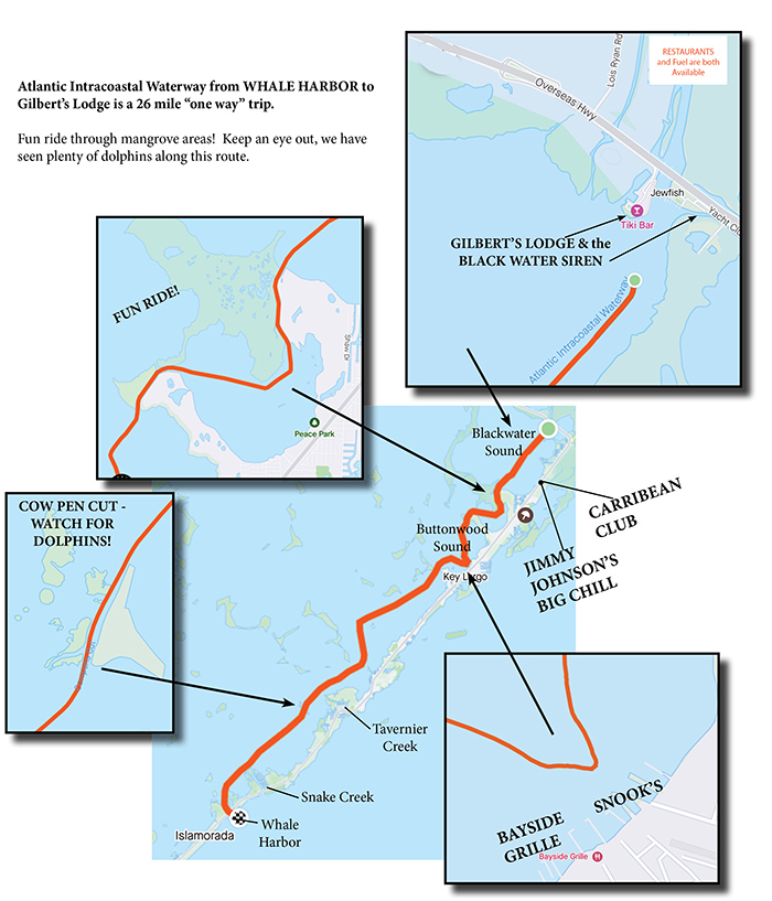
This video below is from the final mangrove cut as we enter into the Blackwater Sound. You'll see a quick view of this large bay - along with where Jimmy Johnson's Big Chill and the Caribbean Club are located too!
After passing by Gilbert's Resort at the Jewfish Creek Bridge, we travel on through the next bay to Alabama Jacks, located at the Card Sound Road Bridge. This restaurant destination is about 5 miles from Gilbert's by boat. There is also boat fuel at Gilbert's Resort if you need it!